

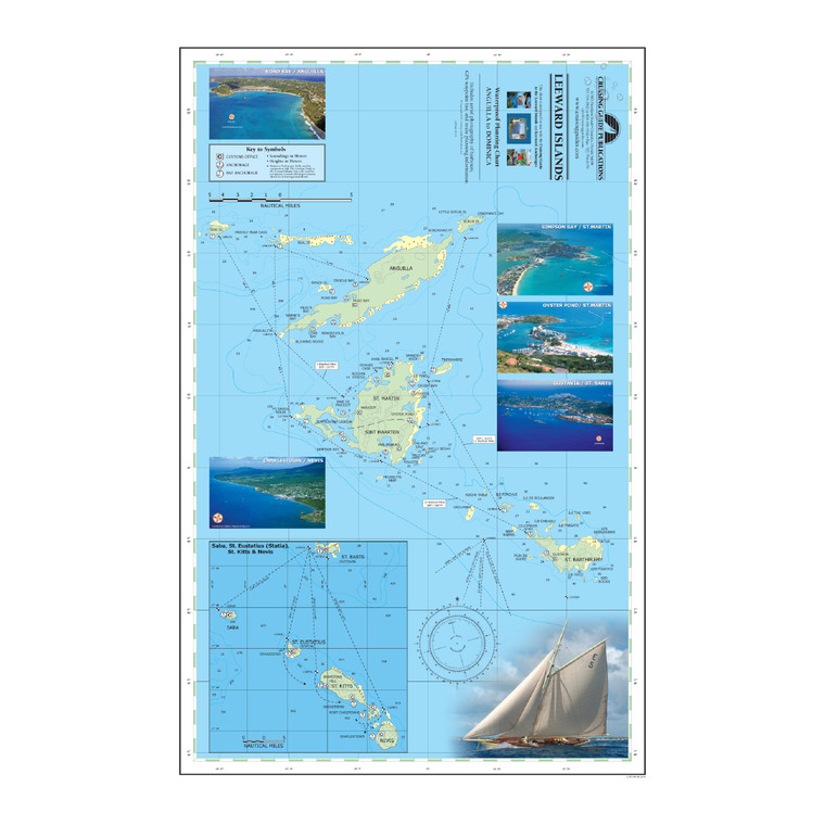
Leeward Islands Waterproof Planning Chart - Anguilla to Dominica
$9.95
(No reviews yet)

Write a Review
Leeward Islands Waterproof Planning Chart - Anguilla to Dominica
Printed on two sides this new chart includes the Leeward Islands from Anguilla to Dominica, covering Anguilla, St. Martin & Sint Maarten, St. Barts, Saba, Statia, St. Kitts, Nevis, Redonda, Montserrat, Antigua, Barbuda, Guadeloupe, Marie Galante, the Saintes, and Dominica. The chart includes anchorage and mooring locations as well as GPS coordinates, sailing routes and distances between waypoints. The waterproof chart is excellent for the cockpit and attractive enough to hang on the wall when you get home. Designed for use with The Cruising Guide to the Northern Leeward Islands and The Cruising Guide to the Southern Leeward Islands, this planning chart is a duplicate of the one you receive in the guides.
23" x 17"

")
")